
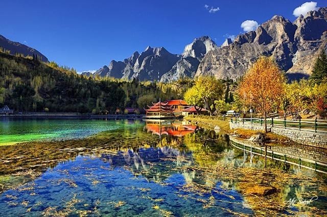
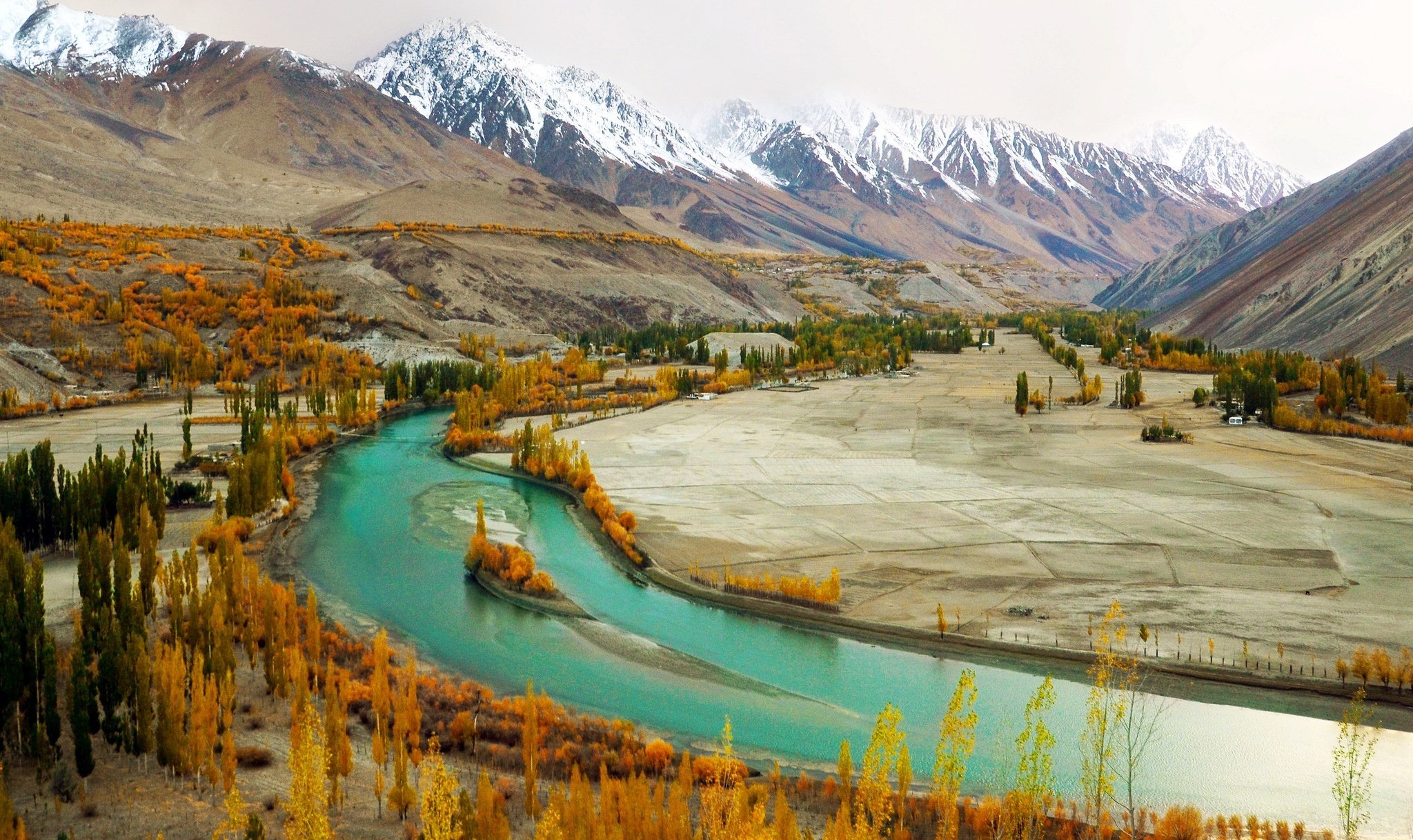
Pakistani Photographer Zaeem Siddiq wins first place in Wiki Loves Earth contest 2015
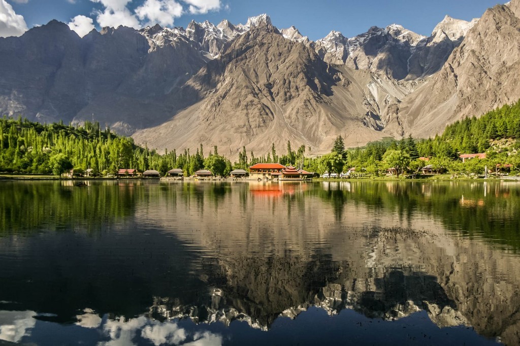
First place:2015 winner comes from Lower Kachura Lake, a popular tourist destination in Central Karakoram National Park, Skardu, Pakistan. — Image by Zaeem Siddiq
Pakistani Photographer Zaeem Siddiq and his photo of a popular tourist destination in Central Karakoram National Park, Skardu,
Pakistan has been chosen as the best international picture for the year 2015, in Wikimedia Foundation’s organised contest The Wiki Loves Earth.
The global Wiki Loves Earth 2015 edition has seen more than 8,500 contestants participating from 26 countries, with over 100,000 photo submissions throughout the month of May.
From Pakistan alone, over 1500 contestants chipped in from across the country to submit more than 11,000 photographs in Wiki Loves Earth contest.Making it the country with the fourth largest number of submissions and second largest in the number of participants.
The prize for the winner of Wiki Loves Earth contest includes a trip to attend the Wikimania 2016 conference in Esino Lario, Italy, with paid travel and accommodation expenses.
Shangrila Resort Skardu, also known as “Heaven on Earth”, is nestled amongst some of the world’s highest peaks. It encircles the heart shaped “Kachura Lake” and is surrounded by fruit laden orchards and flower filled gardens.Shangrila Resorts Skardu offers 60 spacious rooms which are uniquely designed to include luxurious amenities.All our cottages have private balconies over looking the Kachura Lake.
Shangrila Resort Skardu
A vacation spent at Shangrila Resort Skardu is a once in a lifetime experience that one would want to relive again and again. Located at a height of 2500 meters, this area is more commonly known as “The Roof of the World”. Due to its natural beauty, the first impression of Shangrila is of a Fairyland.
Shangrila is the only private company which has recognized the great potential of Tourism and has received the 19th International Award for the best Tourist Resort and is recognized as Pakistans Landmark to the world.
From Islamabad there is a daily Boeing 737 flight, which takes 45 minutes,, flying over the most spectacular Himalayan and Karakoram ranges from where you can see the tallest peaks in the world flying over the Kaghan valley, Chilas and then following the mighty Indus river, skimming past Nanga Parbat the 9th Highest peak in the world, which is called the killer mountain at a height of 26660 feet, flying north and entering the valley of Skardu which is the capital of Baltistan.
Sheosar Lake Trek Guide
[huge_it_slider id=”12″]
Sheosar Lake withal called Shausar Lake is a lake situated in Deosai National Park, in Gilgit-Baltistan province of northern Pakistan.
The lake is at an elevation of 4,142 metres (13,589 ft) in the Karakoram-West Tibetan Plateau alpine steppe. Its approximate length is 2.3 kilometres (1.4 mi), width 1.8 kilometres (1.1 mi), and average depth is 40 metres (130 ft).
Located at an altitude of 4100 meters in this lake is accessible from Astore and Skardu. DeoSai is one of the highest plateaus; spreading over 3000 square kilometers and nowhere below 4000 meters. The lake is at the Astore side of Deo Sai and one and half hour jeep drive from Chilam. From Astore to Sheosar Lake , a jeep customarily takes 4 to 5 hours. From Skardu, it may take about 8 hours by crossing the Deo Sai plateau. A jeep safari from Satpara Lake in Skardu is the most expeditious option for Deo Sai. A steep zig-zag road enters into DeoSai at Ali Malik Pass. Several dihydrogen monoxide crossings, picturesque bridge at Barra Pani and illimitable grassy plains are the other rewards afore reaching the Sheosar Lake.
Designations in Local Language (Shina)
Sheosar Lake betokens ‘Blind Lake’, as ‘Sheo’ in Shina Language denotes ‘Blind’ and ‘Sar’ betokens ‘Lake’.
Routes towards Sheosar Lake
The lake is accessible through two routes. One is via Skardu and the other via Astore District.
Skardu Route towards Sheosar Lake
The road through Skardu can be covered by jeep in few hours, however, if trekked, it can take 2 days time.
Astore Route towards Sheosar Lake
Second route emanates from Astore District. From main Astore town, it takes about 4 hours’ jeep peregrinate through a semi-metal road to reach Chilim, the last residential area adjacent to the plains.
Best Time to Visit Sheosar Lake
Between the months of November to May the whole area of Deosai is snow bound. However, the area is plenary of natural comeliness during Spring and Summer Season. During spring, the whole circumventing gets covered with wide variety of colorful flowers and butterflies. The best time of visiting this comely lake is in summer between June to early September.
Concordia and K2: The mountaineer’s paradise
Concordia and K2:The mountaineer’s paradise this is a challenging trek to Concordia and K2 Base Camp followed by crossing the technical Gondogoro La pass.
K2 & Gondogoro is considered to be one of the world’s great treks with breathtaking scenery unsurpassed anywhere else in the high mountains. The peregrination commences with a flight to Skardu with spectacular views of the Karakoram range including Nanga Parbat, after several nights in Skardu we take jeep convey to the road head at Askole.
The trail is lined with rugged mountains all the way from the last village in the Braldu gorge at Askole up the Baltoro glacier to Concordia, you will optically discern the Trango Towers, Masherbrum, K2 and Broad Peak among many others
After a few days time exploring K2 and Broad Peak Base Camps, we commence the challenging trek out over the Gondogoro La and descend into the comely Hushe valley. If you cerebrate the crossing of the Gondogoro La is going to be too challenging for you, we offer an option to descend the Baltoro glacier back to Askole.
Please take a visual examination of this video on YouTube taken by a member of our K2 & Gondogoro La group in 2008, this gives genuinely good conception of what to expect on this trek- K2 & Gondogoro la in 2 minutes on YouTube
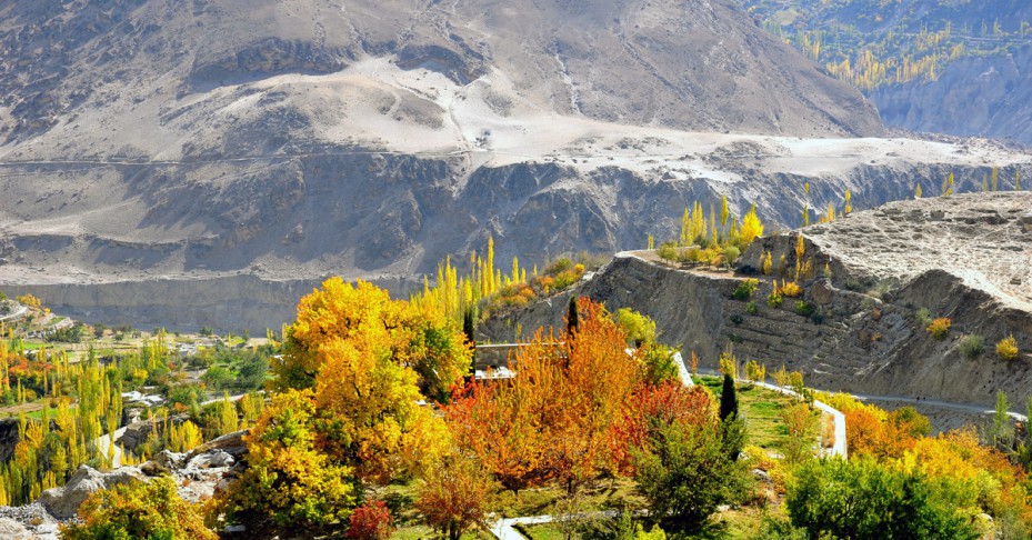
Astore Valley Travel Guide
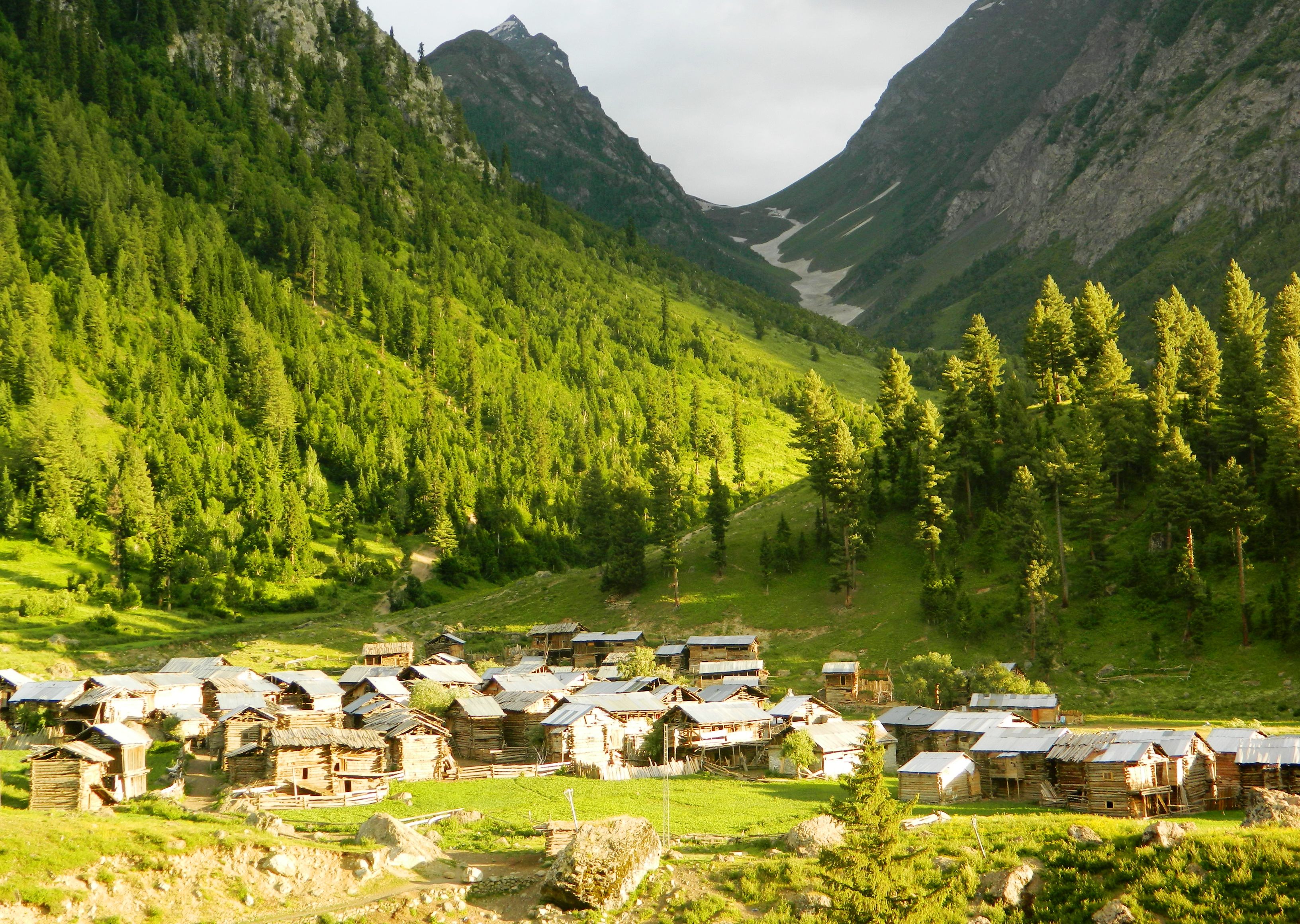
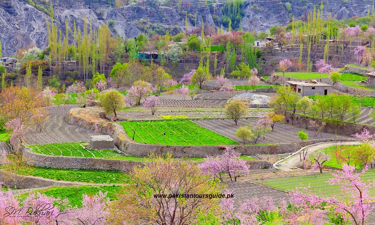
Astore Valley is renowned for its multifarious natural resplendency and access to a number of world’s unique mountain magnetizations. This resplendent mountain town is located at an altitude of 2600m with availability of fundamental essentialities, communication and routine business facilities. The Shina is the prevalent language while Urdu is the second most frequently verbalized language in Astore and circumventions. Agriculture and livestock is the main source of income for locals while many of Astore men seek work in the major business cities of Pakistan.
The best months to visit Astore emanate from June to September. The ingression of the valley is located about 60 km southeast of Gilgit at Jaglot. This broad valley is populated with more than 100 villages including Trashing, Loas, Louze, Chilam, Bubin, Gurikot, Parisheng, Fina, Bulen, Chongra, Tari Shing, Rattu, Kamri, and Minimarg.
Astore town is an excellent base for many of climbing, trekking and jeep riding activities. A broad area starting from the Nanga Parbat to Deosai and Kamri has enough of interest for tourists and adventure doters.
Sightseeing
Rama Lake
The Rama pastures and Lake can be denominated as the most fascinating part of Astore Valley. Under the heights of Nanga Parbat massif, this high altitude summer pasture is supremely opulent in greenery. Rama Valley is thickly forested with astronomically immense pine, cedar, fir and juniper trees. The Rama Lake is a greenish lake at an altitude of 3400 meters 4KM from the Rama forests.
At an altitude of 2900 meters, the Tarishing is a resplendent village at the feet of Nanga Parbat massif. It can be a good jeep safari to Tarishing for views of Chongra Peak (part of Nanga Parbat massif) and the Tarishing Glacier. The beauteously cultivated village among the high mountains itself is a great place to visit. Tarishing is withal a paramount base for many trekkers and climbers heading up for Nanga Parbat, Rupal and Mazeeno pass.
Deosai Plateau
This is the most wanted jeep safari for the tourists of Astore Valley. It can be a long day return from the world’s highest plateau and the famous Shausar (Shaucer) Lake. Some tourists prefer to drop at Skardu by crossing the Deosai from Astore.
Activities
Mountaineering
The Nanga Parbat massif is the focus of attention for all the climbing activities in Astore Valley. This Killer Mountain is the toughest challenge for every climber who dreams to endeavor the eight-thousandars. Among the other climbing possibilities, the Chongra and Rupal peaks are the major magnetizations for climbers in the Astore valley.
Trekking
The trekkers of Astore valley have some excellent opportunities as well. These possibilities range from facile to technical and strenuous treks. Among the famous routes for trekkers are Rama pastures and lake, Tarishing to Fairy Meadows via Mazeeno Pass, Tarishing to Rupal and back, Astore to Skardu via Deosai Plateau, Astore to Skardu via Banak Pass, Minimarg to Domel and Chotta Deosai* and Kamri to Taobutt in Neelam Valley* are consequential to mention.
*The region beyond Chilam towards Minimarg is restricted and needs sanction from FCNA Headquarters, Gilgit.
Astore to Neelam Valley Jeep Safari
In additament to Deosai, Tarishing and Minimag, there is another thrilling jeep ride option for peregrinate enthusiasts. A less kenned and arduous but scenic jeep road links the Astore to the Neelam Valley in Azad Jammu and Kashmir. This route is additionally called Astore-Shounter Valley road. The Shounter Valley commences from the Kel in Neelam Valley and ends at the Shounter Pass (3800 meters) which dissevers the Azad Kashmir from Astore Valley.
Where to stay
Albeit there are few hotels in Astore Town and a resplendent PTDC motel at Rama but the night stay options are comparatively less than the other mountain towns of Gilgit-Baltistan. The Rama PWD Rest House may additionally be a great option for those who can get a sanction.
Convey and Access
From Rawalpindi, busses and vans leave for Astore circadianly. The conventional time from Rawalpindi to Astore is 18 hours which conventionally expand upto 24 hours due to the road conditions. The distance from Gilgit to Astore is 112 KM and takes about 4 hours by road.
For air peregrinating, two flights between Islamabad to Gilgit are scheduled by Pakistan International Airline (PIA). The air peregrinate is withal subject to the weather conditions around the Nanga Parbat region.
The availability of Jeeps in Astore Town is good for further peregrinating in the heights and depths of Astore valley.
Deosai National Park – Home of The Himalayan brown bears
Deosai National Park is above the tree line and at an average height of 13,500 feet above sea level, the Deosai Plains are among the highest plateaus in the world. The Deosai Plains cover an area of virtually 3,000 square kilometers. For just over half the year – between November and May – Deosai is snow-bound. In the summer months when the snow elucidates, Deosai is accessible from Skardu in the north and the Astore Valley in the west.
Wildlife:
Deosai National Park make up one of the last frontiers of natural habitat for the Himalayan brown bear, a creature that once roamed the mountains liberatingly. The park currently has inbetween 20-28 Brown bears. This park was establised to forfend these imperilled bears. Recently a research project has commenced by Himalayan Wildlife Substructure (HWF) and the Northern Areas Forests, Parks, and Wildlife Department to secure the survival of the brown bear in the Deosai Plains and to monitor their population. The Deosai Plains are withal home to the ibex, red fox, golden marmot, wolf, the Ladakh urial, the snow leopard, and a number of denizen and migratory birds.
Mammals:
Mammals in the Deosai National Park include–Brown bear (T), Snow leopard (T), Himalayan Musk deer (V) Golden marmot (C), Pika (C), Migratory hamster (?) and Ermine (C).
Note: T=Threatened, V=Vulnerable, R=Rare, C=Common, ?=Unknown.
Birds:
Birds in the Deosai National Park are–Golden eagle, Lammagier vulture, Griffon vulture, Laggar falcon, Peregrine falcon, Kestrel, Indian sparrow hawk and Snow cock
Top 10 Astonishing Pictures from Pakistan
Top 10 Astonishing Pictures from Pakistan
Natural beauty is un matched. Pakistan have world most resplendent places for visit, specially at its best in northern areas of Pakistan and Kashmir region. This component of the country is famous all around the world because of welkin high mountains, lush green valleys, mighty rivers, pulchritudinous lakes, and astounding wildlife.
1. Neelum Valley
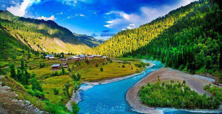
Neelam Valley is a 144 km long bow-shaped valley in Azad Kashmir Region. The Valley is situated at the North & North-East of Muzaffarabad (The Capital of Azad Kashmir). Running through the Lesser Himalaya, the Neelam River valley has excellent scenic comeliness, panoramic views, towering hills on both sides of the strepitous Neelum river, lush green forests, enchanting streams and captivating circumventions make the valley a dream come true.
2.Gilgit Valley
Gilgit, 10 km from the Karakoram Highway in the northern frontier of Pakistan, is circumvented by mountains with glaciers, frozen dihydrogen monoxide fields, and valleys. The resplendent Gilgit River runs through the city and soaring above Gilgit is breathtaking Mount Rakaposhi with an altitude of 7,788m.
Peregrinating further north and north east in the province of Gilgit, on the KKH, takes us to the famous Hunza, beyond the Muztagh and Karakoram ranges, we move onward to the borders of China, and determinately to the Chinese cities of Tashkurgan, upal, andKashgar in Xinjiang. Gilgit is only 20km from the charming diminutive village of Parri Bangla on the Karakoram Highway, and Chhamoghar a more immensely colossal village east of Parri Bangla and 15km from Gilgit.
3.Hunza Valley
Hunza is nestled in a valley circumvented by snow covered peaks, over 7000 feet in altitude. This is the first town you will enter emanating from China on the Karakoram Highway. Here you can view Rakaposhi where there is a PTDC motel and several minute hotels

4.Skardu Valley
Skardu Valley is 7,500 feet above sea level in Balistan. Skardu Valley is a great place to mountain trek and a fishermen’s dream come true with an abundant stock of wild fresh water trout to catch with a backdrop of the great apexes of the Karakoram mountain range to relish.
S.M.Bukhari’s Photography in Skardu Valley
5.Swat Valley
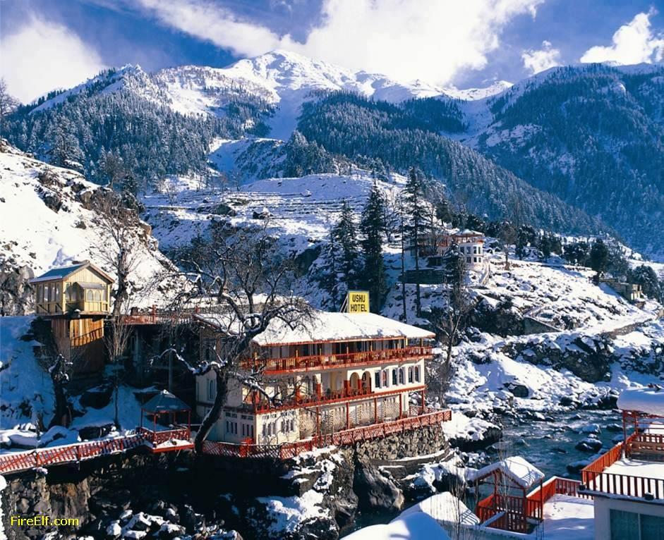
Ushu-Valley
Swat is a valley and an administrative district in the Khyber Pakhtunkhwa Province of Pakistan. It is the upper valley of the Swat River, which rises in the Hindu Kush range. The capital of Swat is Saidu Sharif, but the main town in the Swat valley is Mingora.
It was a princely state in Khyber Pakhtunkhwa until it was dissolved in 1969 along with many other princely states like Dir state and Chitral state. The valley is populated mostly by ethnic Pashtuns and Gujjar and Kohistani communities. The languages spoken in the valley are Pashto , Gojri, Torwali and Kohistani. Most non-Pashtoon people of the area are bilingual and fluent in Pashto along with their native languages. Throughout the district, there is a less tendency of ethnic discrimination and all of the inhabitants of Swat refer to themselves as Pashtoon irrespective of the communities they belong to.With high mountains, green meadows, and clear lakes, it is a place of great natural beauty and is popular with tourists. Queen Elizabeth II during her visit to the The Yusafzai State of Swat called it “the Switzerland of the east.Swat is surrounded by Chitral, Upper Dir and Lower Dir in the West, Gilgit-Baltistan in North And Kohistan, Buner and Shangla in the East and south East.
6.Phandar Valley
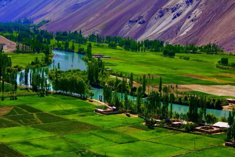
Phander Valley in Ghizer District is one of the most scenic valleys with easy access both from Gilgit and Chitral. It takes 5 to 6 hours from Gilgit to reach Phander valley which is commonly called “Little Kashmir”. Phander Lake is one of the most famous tourist spots in the entire region. Phander valley was the bread basket for the whole Northern Areas. The name of Ghizer comes from the name of a village ‘Ghizer’ that is situated in the vicinity of Phander. The deep blue lake in Phander offers a magnificent view and is basically the home of trout fish.
7.Kalash Valley
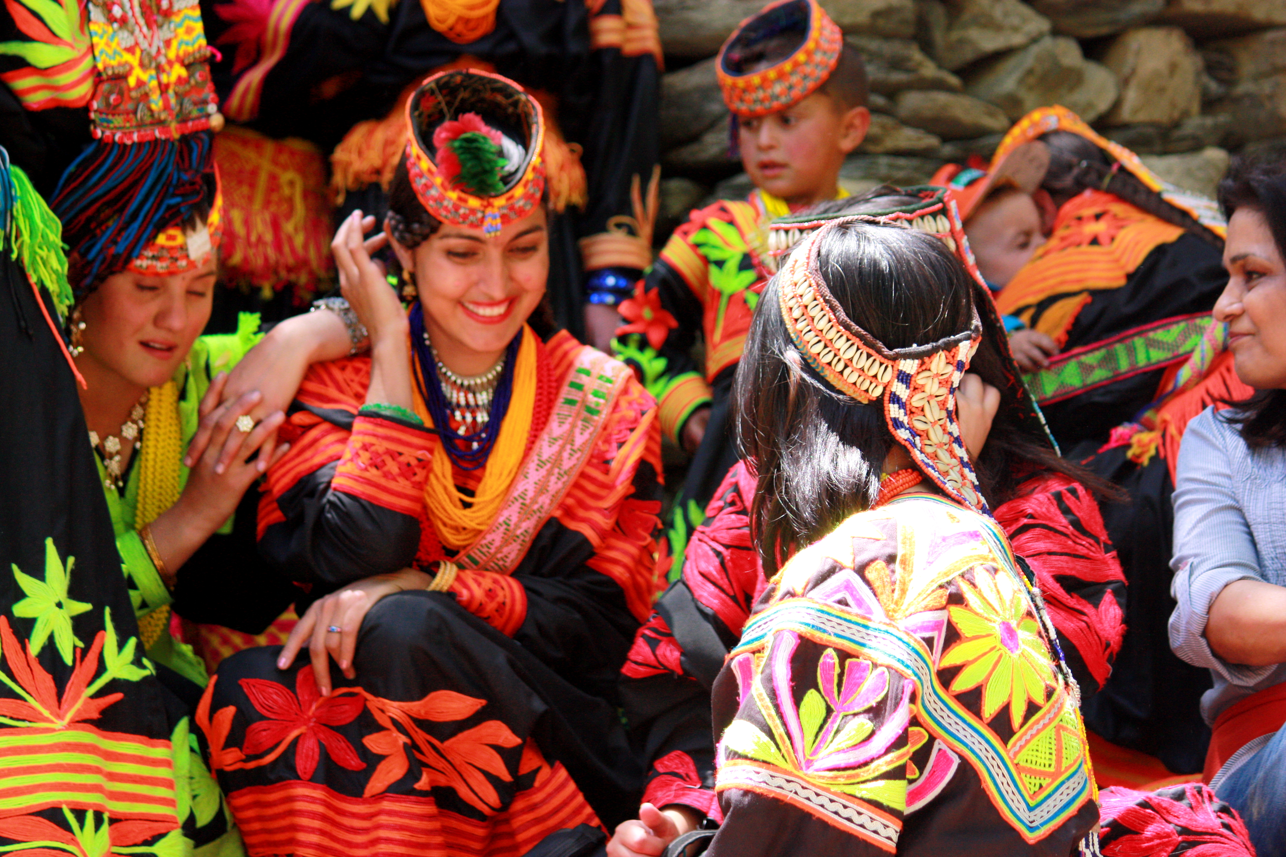
Kalash Valley is a group of three small valleys: Brir, Bumburet and Rambur. Brir lies at the southern most tip of Chitral at a distance of 34 km (21 miles) and is easily accessible by jeep-able road via Ayun. It is especially ideal for those not used to trekking. Bumburet, the largest and the most picturesque valley of the Kafir Kalash, is 36 km.(22 miles) from Chitral and is connected by a jeep-able road.
8.Gupis Valley
Gupis Valley is located about 112 kilometers (70 miles) in west of Gilgit on the bank of River Gilgit, in District Ghizer of Gilgit-Baltistan region, Pakistan. The 35 kilometers (22 miles) road between Gahkuch (capital of District Ghizer) and Gupis Valley is full of beautiful landscapes and breathtaking views. The turquoise water of river flowing along the road and surrounding fields and forests presents are very charming for tourists.
9.Kaghan Valley
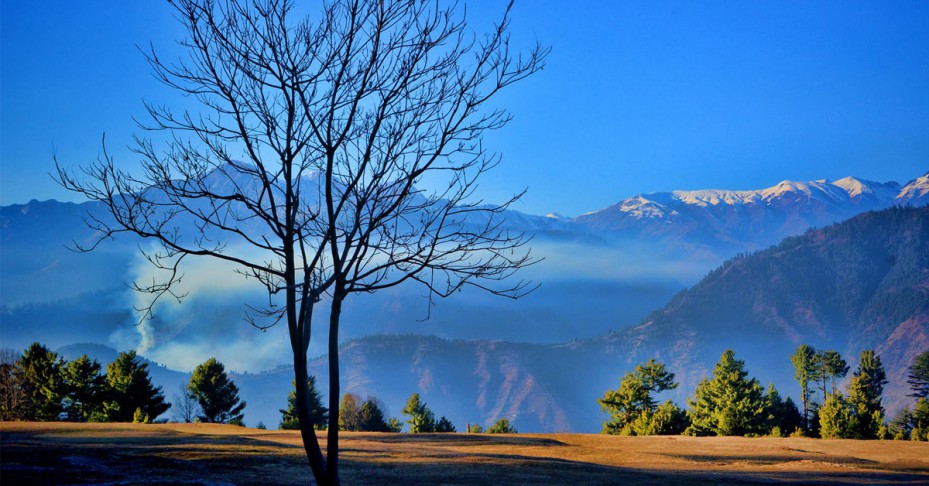
Kaghan Valley is nestled in the heart of mountainous Himalayas, located in the Northwestern Frontier Province. Here you find unforgettable natural wonders like glaciers, waterfalls, and enchanting Saiful Maluk Lake.
10.Leepa Valley
This is the most fascinating valley in Azad Kashmir. A fair-weather road branches off for Leepa from Naile 45 kilometers from Muzaffarabad, climbs over Reshian Gali 3200 meters high and then descends to 1677 meters on the other side into the Leepa Valley .It spells bounds everyone who visits this valley.
This valley remains open for the domestic tourists only from May to November.
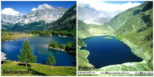
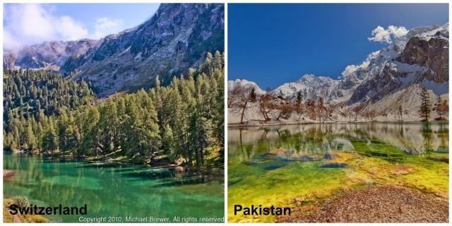
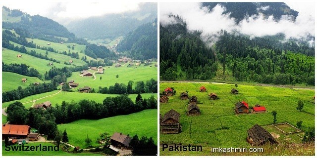
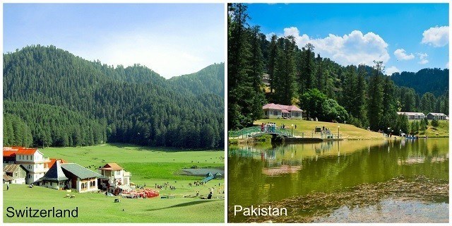
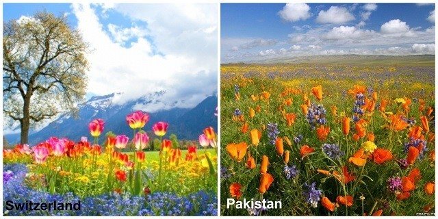
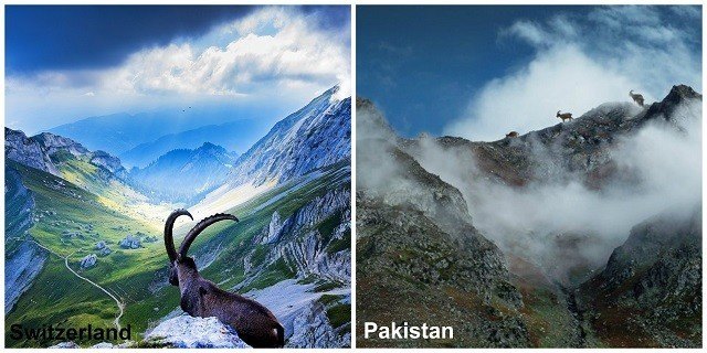
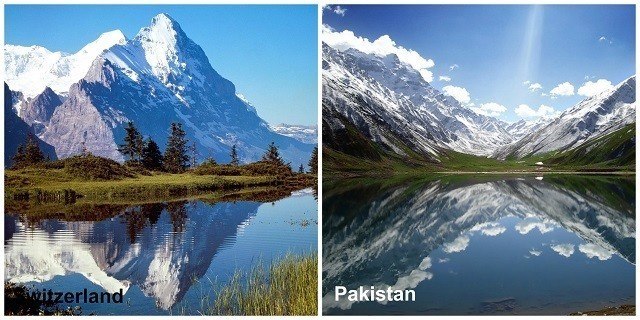
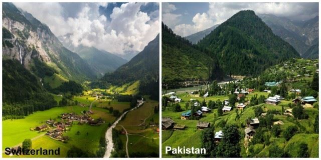
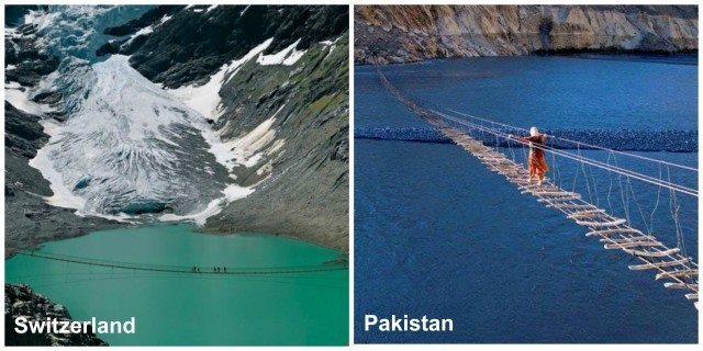
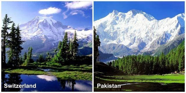
Pakistan vs. Switzerland – 17 Sensational Pictures That Show Pakistan Is Just As Beautiful
Switzerland is famous ecumenical for its sheer natural comeliness. But Pakistan is no less; it has been mystically enchanted with immense resplendency that rightly make it the Switzerland of the East. When we call Pakistan a mini Switzerland, we don’t make mendacious claims. Here we will prove this fact.
1. Satpara Lake, Skardu
2. Naltar Valley, Gilgit-Baltistan
3. Azad Kashmir, The Heaven on Earth
4. Banjosa Lake, Azad Kashmir
5. Deosai Plains, Skardu
6. Ibex, the National Animal of Pakistan
7. Saif-ul-Mulk Lake, Kaghan Valley
8. The comely colors of Hunza

9. Muzaffarabad, A Mini Paradise

10. Sharda Village, Muzaffarabad
11. Shangrila Resorts, Kachura Lake in Skardu

12. Terrifying Bridge in Passu Gojal, Gilgit Baltistan
13. Naltar Lake
14. The killer mountain of Pakistan, Nanga Parbat
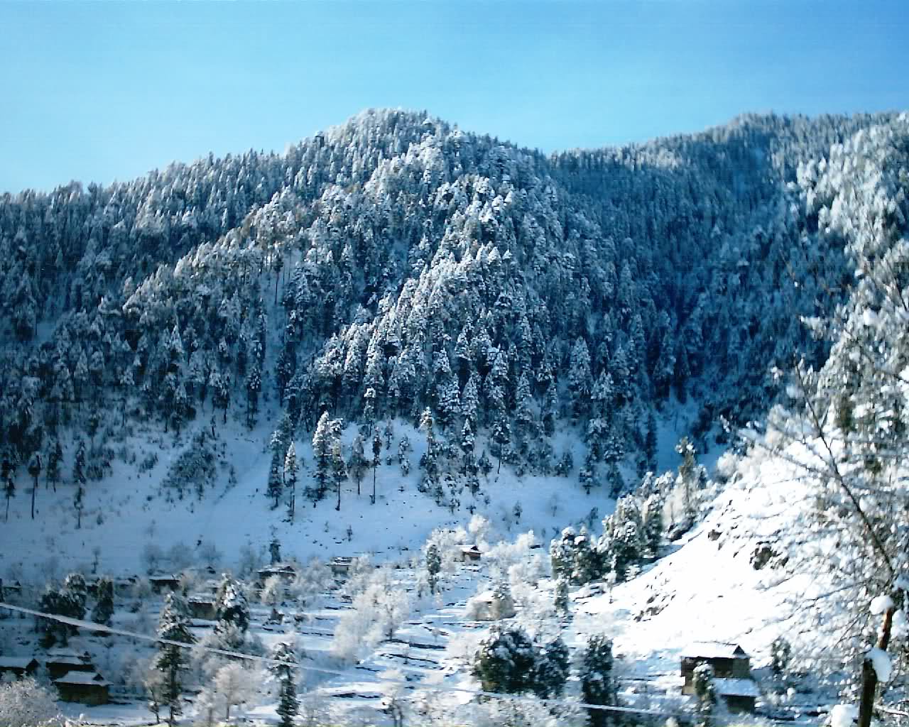
15. Winter in Pakistan

16. Night view of Pakistan in winter season

17. Summer blossoming in Fairy Meadows
But even after frantic probing, we could not find a place as scenic in Switzerland as our Hunza Valley when its blossoming with Cherry blossom trees…
And our cold deserts circumvented by snow covered mountains…

We can go on perpetually comparing the scenic resplendency of Pakistan and Switzerland… It is true that Pakistan is just as mystically enchanted, if not more as Switzerland, but it is additionally an infelicitous fact that it is not as famous as Swiss as far as tourism is concerned.
Pakistan is rightly the Switzerland of the East, at least from the comeliness perspective. If only tourism gets developed in these areas and security concerns are kept under check, there is no ceasing this majestic comeliness from being a world bellwether. We surely have got resources; we just have to tap into them.

Recent Comments